vector isolated illustration simplified administrative map france colorful silhouettes

navigate by keyword : administrative background border bright brittany business cartography colorful concept contour corsica country county division est europe flat france french geography grand graphic guadeloupe guiana hauts icon illustration isolated land map metropolitan nation national normandy occitanie outline overseas province region shape sign silhouette simplified state symbol template travel vector white world

Vector isolated illustration of simplified administrative map of France. Colorful silhouettes Royalty Free Stock Photo
Vector isolated illustration of simplified administrative map of France. Borders and names. Colorful blue silhouettes Royalty Free Stock Photo
Vector isolated illustration of simplified administrative map of France. Borders and names of the regions Royalty Free Stock Photo
Vector isolated illustration of simplified administrative map of France. Borders  of the regions. Royalty Free Stock Photo
Map City of Ile de France, Vector isolated illustration of simplified administrative map of France. Borders and names of the Royalty Free Stock Photo
   
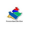
Map City of Provence Alpes Cote d Azur, Vector isolated illustration of simplified administrative map of France. Borders and names Royalty Free Stock Photo
Vector isolated illustration of simplified administrative map of France. Colorful silhouettes
Map City of Corsica, Vector isolated illustration of simplified administrative map of France. Borders and names of the regions. Royalty Free Stock Photo
Map City of Ositania, Vector isolated illustration of simplified administrative map of France. Borders and names of the regions. Royalty Free Stock Photo
Map City of Martinique, Vector isolated illustration of simplified administrative map of France. Borders and names of the regions Royalty Free Stock Photo
Map City of Grand Est, Vector isolated illustration of simplified administrative map of France. Borders and names of the regions. Royalty Free Stock Photo
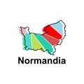
Map City of Normandia, Vector isolated illustration of simplified administrative map of France. Borders and names of the regions. Royalty Free Stock Photo
Map City of Guyane Francaise, Vector isolated illustration of simplified administrative map of France. Borders and names of the Royalty Free Stock Photo
Map City of Bretagne, Vector isolated illustration of simplified administrative map of France. Borders and names of the regions. Royalty Free Stock Photo
Vector isolated illustration of simplified administrative map of France. Borders of the regions. Colorful silhouettes


Stockphotos.ro (c) 2025. All stock photos are provided by Dreamstime and are copyrighted by their respective owners.