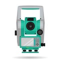
geodetic tool for measuring total station isolated white background vector illustration |
||||||||||||||||||||||||||||||||||||||||
navigate by keyword : accuracy angles background cadastre cartography coordinates device distances electronics engineering equipment estimate flat geodesy geometry goniometer graphic gray green hardware heights illustration industry instrument isolated land leveling line management maps measure measurements monitoring object optics professional quality rangefinder scale scanning station survey surveying tacheometer tachymeter technology terrain theodolite tool topographic topography total vector white |
||||||||||||||||||||||||||||||||||||||||
|
||||||||||||||||||||||||||||||||||||||||
Geodetic tool for measuring distances and angles ââ¬â total station ââ¬â isolated on a white background. Vector illustration |
||||||||||||||||||||||||||||||||||||||||
Stockphotos.ro (c) 2025. All stock photos are provided by Dreamstime and are copyrighted by their respective owners. |