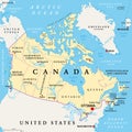
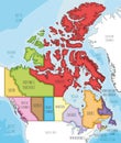
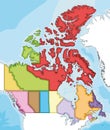
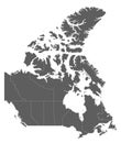
canada administrative divisions provinces and territories political map |
||||||||||||||||||||||||||||||||||||||||
| navigate by keyword : administrative alberta america arctic atlantic atlas border boundary british brunswick canada canadian capital cartography circle columbia country division divisions edward geography greenland illustration infographic island labrador land manitoba map mapping nation new newfoundland north northwest nova nunavut ocean ontario ottawa political prince province provinces quebec saskatchewan scotia state states territories territory toronto travel united vector yukon |
||||||||||||||||||||||||||||||||||||||||
|
||||||||||||||||||||||||||||||||||||||||
| Canada, administrative divisions, political map. The ten provinces and three territories of Canada, with their borders and capitals. Country in North America, and second largest country of the world. |
||||||||||||||||||||||||||||||||||||||||
|
Stockphotos.ro (c) 2025. All stock photos are provided by Dreamstime and are copyrighted by their respective owners. |
||||||||||||||||||||||||||||||||||||||||